Drone & Mapping
Aerial imagery built for buying and selling land
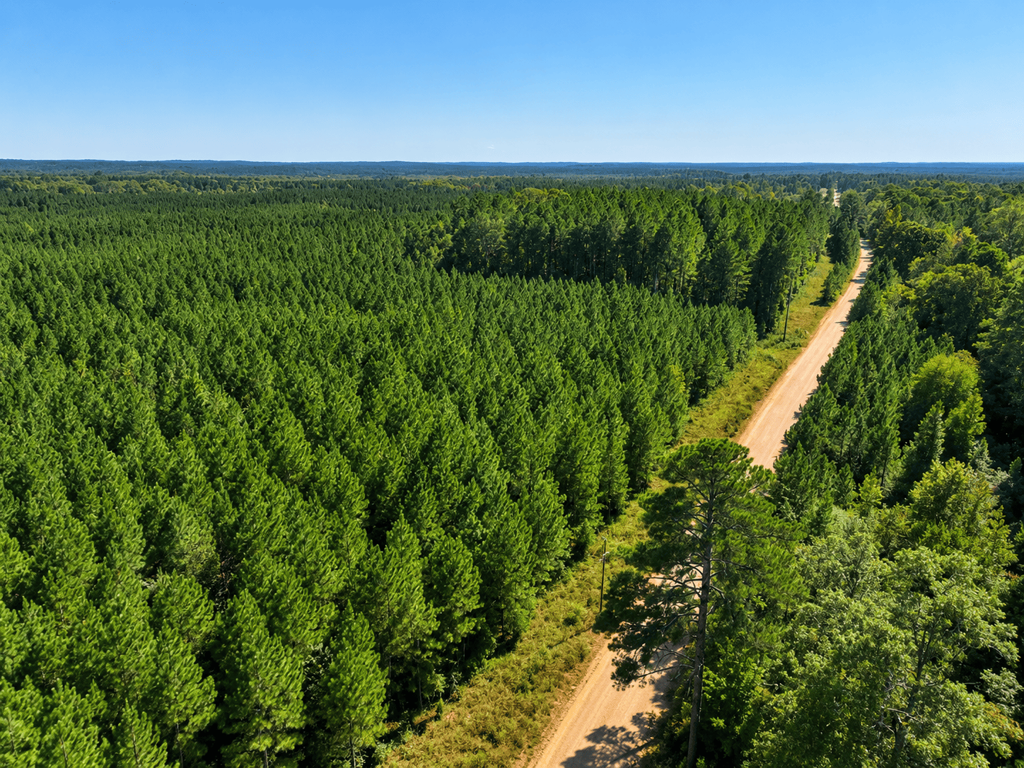
High-resolution drone photography, video, and boundary mapping that help land sell faster and help buyers see exactly what they're getting.
Service Overview
Drone imagery is one of the most effective tools in modern land sales. We use it on our own listings and offer it as a service for landowners, agents, and timber buyers across Mississippi and Alabama.
Listing-grade media
Cinematic stills and video that show acreage, water, timber, and access the way a walk on the property would.
Boundary visualization
Overlay parcel lines, roads, and food plots so buyers understand the tract before they ever visit.
Acreage verification
Drone-assisted measurement to confirm what's actually on the ground versus what the deed says.
What You Get
Built to support land ownership, sales, and value
FAA-compliant pilots
Licensed, insured, and experienced flying rural tracts and remote acreage.
4K stills + video
Print- and web-ready files delivered fast, sized for MLS, listings, and social.
Annotated maps
Boundary overlays, water features, timber stands, and key access points.
Buyer-first composition
We've sold this land — we know which shots actually move a buyer to the table.
Why It Matters
Better imagery sells land for more
Most land is bought from the air before it's ever walked. Crisp aerial media gives buyers a complete picture: shape, terrain, timber, water, and access. Sellers see fewer tire-kicker showings and stronger offers. Buyers gain confidence to act.
- Faster days-on-market for listed tracts
- Stronger position in price negotiation
- Documentation you keep for refinancing, estate planning, or future resale
Related Land Services
One team across land brokerage and stewardship
Need drone work on a tract in MS or AL?
Tell us about the property and we'll line up a flight.
Reference
More about drone photography and mapping for land
Drone photography for land in Mississippi and Alabama has become an essential tool for showcasing, evaluating, and managing rural properties. When it comes to marketing land or understanding large tracts of timberland, aerial imagery provides a perspective that simply can’t be achieved from the ground.
At Crew Land Co., we use drone photography to give buyers, sellers, and landowners a clearer, more complete view of a property. From highlighting key features to supporting forestry and land management decisions, aerial imagery helps tell the full story of the land. Drone photography for land in Mississippi and Alabama gives both buyers and landowners a better understanding of property layout, features, and long-term potential.
Drone Photography for Land in Mississippi and Alabama for Property Sales
When marketing land for sale in Mississippi and Alabama, first impressions matter—and nothing captures attention like high-quality aerial imagery.
Drone photography allows us to showcase properties in a way that helps buyers immediately understand layout, scale, and usability. Instead of relying only on ground-level photos, aerial views provide context—showing how everything connects across the property.
With professional drone photography, we can highlight:
- Timber stands and overall forest composition
- Road systems, trails, and access points
- Water features like ponds, creeks, and drainage areas
- Open fields, food plots, and wildlife corridors
- Property boundaries and surrounding land use
This type of visual storytelling brings a property to life. Buyers aren’t just looking at photos—they’re gaining insight into how the land can be used, whether for hunting, recreation, farming, or timber investment.
If you’re selling land, aerial video is one of the most effective ways to stand out in today’s competitive market. Drone photography for land in Mississippi and Alabama helps buyers visualize the property before they ever visit, creating stronger interest and more qualified inquiries.
Why Drone Photography for Land in Mississippi and Alabama Makes a Difference
Land is different than traditional real estate. You can’t always walk every acre, and some of the most valuable features aren’t visible from the road.
Drone photography solves that.
It gives buyers:
- A full-property perspective in minutes
- A better understanding of terrain and usability
- Confidence in what they’re considering
Drone photography for land in Mississippi and Alabama helps bridge the gap between what a property looks like on paper and what it actually offers on the ground.
For sellers, it creates stronger listings that attract attention and help properties stand out online—where most buyers begin their search.
Drone Photography for Land in Mississippi and Alabama for Forestry & Land Management
Beyond marketing, drone photography plays a critical role in land management and forestry consulting in Mississippi and Alabama.
Managing timberland requires understanding what’s happening across the entire property—not just what you can see from a truck or trail. Drone photography allows landowners and foresters to evaluate large tracts efficiently and accurately.
Using drone photography for land in Mississippi and Alabama, we can:
- Assess timber stand density and overall forest health
- Identify areas for thinning, prescribed burns, or improvement
- Monitor wildlife habitat and movement patterns
- Detect early signs of pest damage or disease
- Evaluate erosion, drainage, and road conditions
This level of visibility helps landowners make informed, proactive decisions that improve the long-term health and value of their property.
Supporting Smarter Forestry Decisions
Forestry is a long-term investment, and small decisions today can have a major impact down the road.
With drone technology, Crew Land Co. provides insight into timber conditions and helps develop management strategies that align with your goals—whether that’s maximizing timber value, improving wildlife habitat, or maintaining sustainability.
During active timber operations, drone photography can also:
- Monitor harvesting progress in real time
- Ensure best management practices are followed
- Identify potential issues before they become costly problems
Drone photography for land in Mississippi and Alabama allows for better oversight and more confidence in how your land is being managed.
A Better View of Your Land
Whether you’re buying, selling, or managing land, having the right information makes all the difference.
Drone photography for land in Mississippi and Alabama provides a clear, accurate, and efficient way to understand your property from a higher level—both visually and strategically.
At Crew Land Co., we combine aerial technology with real-world land expertise to give you a complete picture of your property and its full potential.
Work with Crew Land Co.
If you’re considering drone photography for land in Mississippi and Alabama, our team is here to help you showcase, evaluate, and manage your property with confidence.
From marketing land listings to supporting forestry and land management decisions, we’re ready to help you take the next step.
Follow us on Facebook to stay up to date on new listings and helpful tips.